| Police Districts and Police Service Areas | |
|
Crime's a serious problem, no
question about it. There's a presumption that the Metropolitan Police
Department (MPD) ought to be able to do something about it. Unfortunately,
while the MPD is all too quick to claim credit for decreases in crime,
they'll be the first to admit that they can in fact do very little to
prevent crime. Where there is poverty, and weak families, and a neighborhood youth
culture that glorifies crime and criminals, there will be
crime.
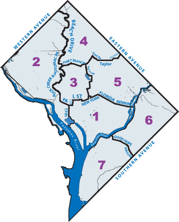
There's a powerful west-to-east gradient in crime rates. Way to the west, in the upscale neighborhoods of Ward 3, there's not much crime. The farther to the east you go, through Ward 1, then across the Anacostia, the higher the crime rates. (And the real crime rates are still higher, because more crimes go unreported.) Here's a map of the PSAs (Police Service Areas) of the District. Districts 2 and 4, high-income neighborhoods, have relatively low crime rates. Mount Pleasant is at the northwest corner of the Third District. Though the smallest district in area, 3D has the highest population of all the police districts. |
|
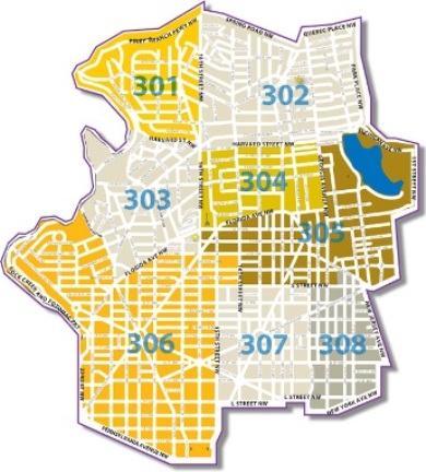
| Here's
the map of the Third Police District, comprising seven PSAs. PSA 301 is
precisely coterminous with the conventional boundaries of Mount Pleasant,
identical in particular to the boundaries of ANC 1D. PSA 302 includes
mostĀof Columbia Heights. PSA 303 is Adams Morgan, while 304 is a
southern continuation of Columbia Heights, and PSA 305 includes the
burgeoning U StreetĀ- Cardozo - Shaw area. September 2007: PSA 306 transferred to 2D Links: Homepage Comparing robbery rates Robberies in Mount Pleasant |
|